
1940: 6,000 troops camped in Sparkes’ Paddock.
1941: Commonwealth resumes Sparkes’ Paddock as Japan enters the war.
1942: U.S. Troops arrive in Brisbane.
1943: Plane crash in Sparkes’ Paddock.
1945: Camp closed and was partly used to house homeless people.
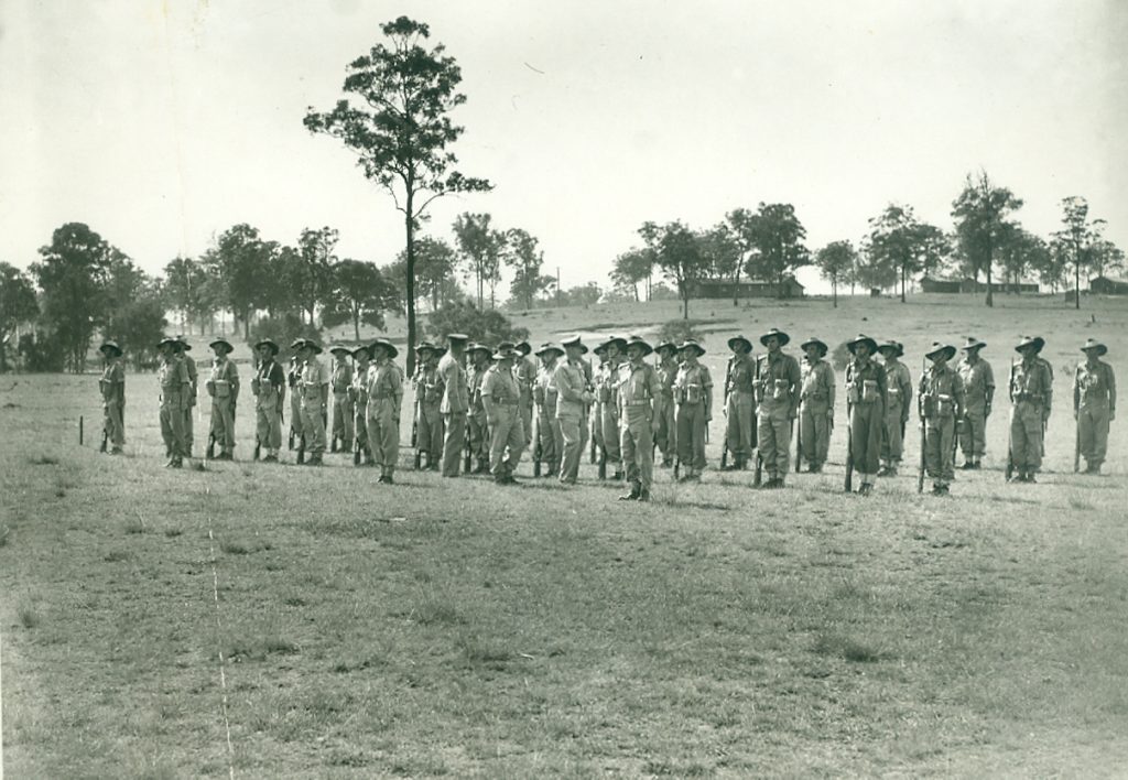
Growth was slow during the 1930s partly due to the Great Depression but employment quickly increased when the 1939-1945 World War II broke out and Chermside experienced the huge impact of the Army Camp in Sparkes’ Paddock, today’s 7th Brigade Park. This war marked a major turning point in Chermside because it was followed by a major house-building boom, which changed it from an outlying, almost country town to a suburb of Brisbane.
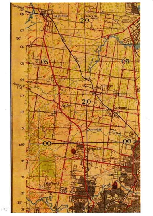
The 1937 map shows more growth mainly on the west side of Gympie Road. A few more short streets are filling in the central area. On the east side of Gympie Road, Latham and Sparkes Streets seem to have many houses while Norman Avenue and Kidson Terrace have appeared and Wallace Street has a few more houses. View, Ethel, Sammells, Davenport, Henry, Farnell, Hilltop and Rainey Streets have appeared.
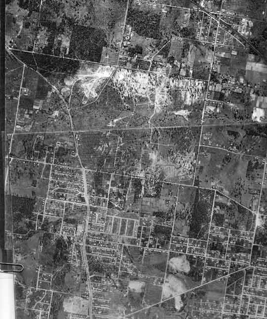
This 1946 aerial photo shows Chermside on the western side of Gympie Road (off map) stretching past Webster Road into the small farms and bushland, which became the future Chermside West, with McDowall to the south-west and Bridgeman Downs to the north-west.
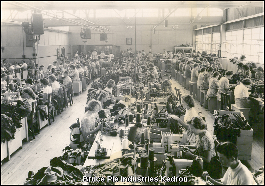
1946: Bruce Pie buys land to build a textile factory in Kedron; he eventually employed 800 people.
1947: Telephone exchange in Chermside. Trams arrive in Chermside and this cheap transport enabled many people to build homes in the local area at a time when few people owned automobiles. There was a Post-War building boom. Houses were needed, and finance was made available by banks and governments. Commonwealth/State Housing Commission built low-cost, asbestos-cladded houses while private builders concentrated on timber and tin houses. Local population rose.
1949: 400 houses built.
1952: Burnie Brae house demolished. Green belt planning introduced, which froze large portions of land. On the eastern side of Webster Road, 88 acres (35.6ha) were resumed for a hospital and school. The school was never built so it all became land for what would become The Prince Charles Hospital and St Vincent’s Hospital. Housing Commission built 800 homes.
1954: Chermside Chest Hospital now the Prince Charles Hospital built. Another 665 houses built.
1954: Fire Brigade station opened on Hamilton Road.
1955: Brisbane Cash and Carry opened on the corner of Hamilton & Gympie Roads.
1956: William Basnett wins a case in Land Court to be able to subdivide his land, which was in the Green Belt; many other landholders were now able to subdivide too.
1957: The Drive-in Shopping Centre opened and was the first in Australia. The shopping centre had 28 acres (11.3ha) right in the middle Chermside at the tram terminus. Also, it was estimated that 100,000 people were or would be living within a 5km radius of the proposed site. The automobile was becoming more common and people who used to drive into the city to shop could now come to Chermside. It was so successful that in 1959 Myers from Melbourne bought it and expanded it.
Chermside was in the right place at the right time; the land was available, the cheap transport had arrived, hundreds of married couples wanted new homes, the finance was available, builders, and architects were available. Then Tom Weedman came looking for a site on which to build Australia’s first Drive-In Shopping Centre. The best site was Chermside right at the tram terminus, 28 acres in Early’s Paddock. The incredible story of the Chermside Shopping Centre had begun. It was a big gamble that paid off way beyond anybody’s expectations.
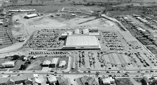
The aerial photo is taken to the south of Hamilton Road, looking north. The large building in the front is Allan & Stark Department Store, to the left rear is the BCC Supermarket and the two long narrow buildings are the arcade with housing for 25 specialty shops. Hamilton Road is in the foreground, the then newly-built Playfield Street is on the right, Gympie Road is off to the left and Banfield Street is in the background. The big circle in the parking area is a helicopter pad used on the day. Image courtesy of the Myer Archive Library of Victoria.
Allan & Stark Drive-in Shopping Centre 1957 comprised:
One department store – Allan & Stark
One supermarket – Brisbane Cash and Carry
25 specialty retail stores
700 car parks
For those who didn’t own a car they could catch a bus or tram to the shops and walk across the road. You could also have your purchases delivered.
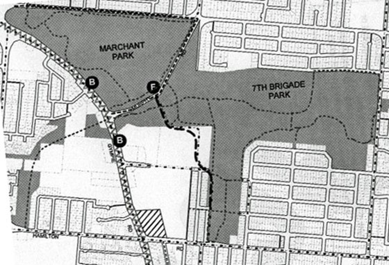
A very important part of available space was due to Edgar Huxtable's 1864 survey which set aside the huge 203ha (504 acre) Murphy’s Paddock in the heart of Chermside. Murphy’s Paddock provided space for some 1,200 houses in the North-East and South-East corners, the 40ha (100 acres) of Marchant Park and the 73ha (180 acres) of 7th Brigade Park as well as space for the Library, Kedron-Wavell Services Club and the Aquatic Centre. The blank section above Banfield Street and marked by the letter B was Commonwealth land used by the old PMG and, later Telstra. It also contained the Tax Office and Commonwealth Centre.
In 1963 Brisbane City Council acquired the remaining 71 hectares of Sparkes’ Paddock from the Australian Government and renamed it the Hamilton Road Reserve. This was followed by the building of the Chermside Pool in 1964, the Kedron-Wavell RSL Complex beginning in 1970, the Chermside Library in 1997 and the Chermside Historical Precinct in 2000.
In March 1996, the area was renamed 7th Brigade Park in memory of the men who trained here and fought so courageously at Milne Bay where they inflicted the first-ever defeat of the Imperial Japanese Army. Thousands of young men trained here before moving on to the battlegrounds of New Guinea and the Pacific Islands; some 560 of them never returned and twice that number were wounded.
The blank section in the corner of Gympie and Hamilton Roads reaching north to Banfield Street and east to Playfield Street was Early’s Paddock and not part of Murphy’s Paddock. The Westfield Shopping Centre now occupies most of Early’s Paddock and most of the old Commonwealth land to Downfall Creek.
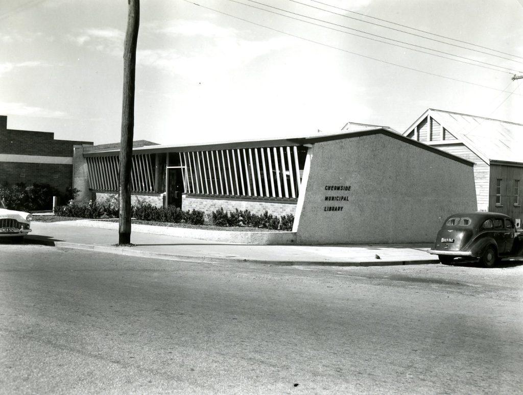
1958: Brisbane City Council Municipal Library replaced the School of Arts.
1959: Ambulance Transport Brigade opened in Banfield Street. Brisbane City Council buys the remaining 180 acres of Sparkes’ Paddock renamed Hamilton Road Reserve.
1962-1964: The Commonwealth Department of Housing acquired 70 acres of Sparkes’ Paddock to build 320 homes as War Service Houses. Qld Housing Commission later built 975 homes under its Home Ownership Schemes.
1962: The new Post Office was officially opened by Mr. R.C. O’Brien, M.P. for Petrie. Mr. E. C. McLean Postmaster – first purpose-built Post Office in Chermside.
1963: Reservoir built on Milne Hill to supply water to thousands of houses.
1963: Brisbane City Council acquired the remaining 175 acres of Sparkes’ Paddock from the Commonwealth Government, which became the Hamilton Road Reserve and later 7th Brigade Park. (Chermside Parklands Planning Study – BCC p.24)
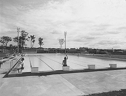
1964: Brisbane City Council Swimming Pool on Hamilton Road opened in December 1964.
1966: Woolworths opens Australia’s largest supermarket in Chermside.
1968-1971: Kedron-Wavell Services Club formed, developed, and opened.
1969: Last tram to Chermside – private cars and council buses had replaced the electric tram.
The old boundary of Chermside was a complicated one which weaved and ducked around many streets. It was probably drawn up in the 19th century when settlements were scattered and it simply tried to include as many as possible.
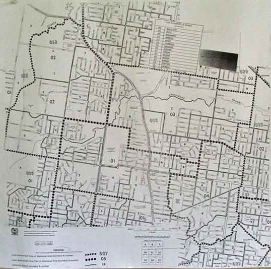
Before 1975 the size of Chermside was 15.6 square km. The new suburbs of Bridgeman Downs and McDowall were not part of old Chermside but lay to the west. To track the boundary on the map just follow the arrow heads. The current boundaries are much simpler than the old ones, especially on the east with Wavell Heights and the south with Kedron. Chermside is now ‘landlocked’ and future horizontal expansion is very limited so most new expansion will be vertical.
To read about Chermside during the 1980s to the present, click here.
This text was written by Patrick O'Shea in 2010. It was updated by Sherry Mackay, Julia van Zon, and Bradley Scott in 2023, and by Bradley Scott in 2025.


All content © 2010-2026 Chermside & Districts Historical Society